
Here at Thorpe Helsey Primary School, we are very passionate about geography and feel it is crucial for our children to learn about the world. We feel teaching geography allows children to develop an understanding of the world and people around them and develop a sense of place. This in turn develops connections, empathy and tolerance as well as helping to build the social and emotional foundation children need and will one day use as adults.
Our geography curriculum is bespoke and has been developed by staff using the National Curriculum as a basis. The key principles on which this is based is that it is real, relevant and engaging.
Geography is taught at Thorpe Helsey Primary School from EYFS to Year 6. They are usually used as the topic drivers for the half termly/termly topics for each year group.
Geography is taught during the afternoon sessions however where possible reading, writing and maths are linked to the topic. This is especially evident with our class novels.
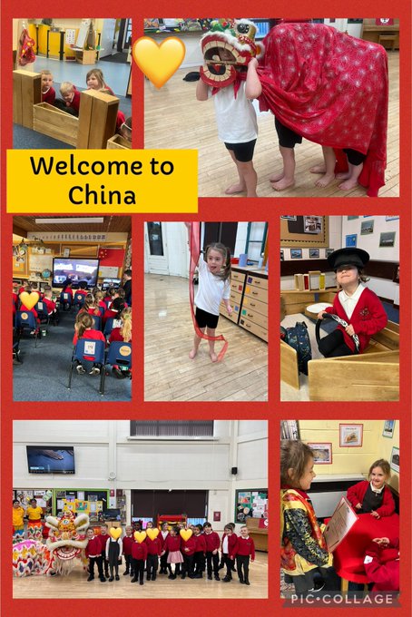
During the spring term, we will be having our multi-cultural half term where each year group will focus on a different country from around the world. They will learn where that country is, the physical and human features of the country and compare them with where they live.
Overview by Stage
Understanding the World EYFS
People, Culture and Communities ELG:
Children at the expected level of development will:
- Describe their immediate environment using knowledge from observation, discussion, stories, non-fiction texts, and maps;
- Know some similarities and differences between different religious and cultural communities in this country, drawing on their experiences and what has been read in class;
- Explain some similarities and differences between life in this country and life in other countries, drawing on knowledge from stories, non-fiction texts and – when appropriate – maps.
Key Stage 1
The National Curriculum for geography aims to ensure that all pupils:
- develop knowledge of the location of places of global significance, their defining physical and human characteristics and how they relate to one another; this place knowledge should provide a sound context for understanding geographical processes
- understand the processes that give rise to key physical and human geographical features of the world, how these are interdependent and how they bring about spatial variation and change over time are competent in the geographical skills needed to:
- collect, analyse and communicate with a range of data gathered through experiences of fieldwork that deepen their understanding of geographical processes
- interpret a range of sources of geographical information, including maps, globes, aerial photographs and Geographical Information Systems (GIS)
- communicate geographical information in a variety of ways, including through maps and writing at length.
Pupils should develop knowledge about the world, the United Kingdom and their locality. They should understand basic subject-specific vocabulary relating to human and physical geography and begin to use geographical skills, including first-hand observation, to enhance their locational awareness.
Pupils should be taught to:
- name and locate the world’s continents and oceans
- name, locate and identify characteristics of the four countries and capital cities of the United Kingdom and its surrounding seas
- understand geographical similarities and differences through studying the human and physical geography of a small area of the United Kingdom, and of a contrasting non-European country
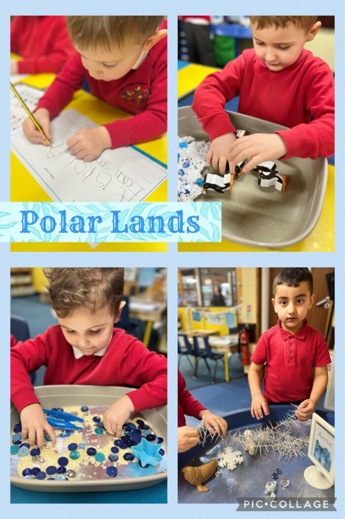
- identify seasonal and daily weather patterns in the United Kingdom and the location of hot and cold areas of the world in relation to the Equator and the North and South Poles
- use basic geographical vocabulary to refer to:
- key physical features, including: beach, coast, forest, hill, mountain, ocean,
- river, soil, valley, vegetation, and weather
- key human features, including: city, town, village, factory, farm, house, office, and shop
- use world maps, atlases and globes to identify the United Kingdom and its countries, as well as the countries, continents and oceans studied at this key stage
- use simple compass directions (North, South, East and West) and locational language (e.g. near and far) to describe the location of features and routes on a map
- use aerial photographs and plan perspectives to recognise landmarks and basic physical features; devise a simple map; and use and construct basic symbols in a key
- use simple fieldwork and observational skills to study the geography of their school and the key human and physical features of its surrounding environment.
Key Stage 2
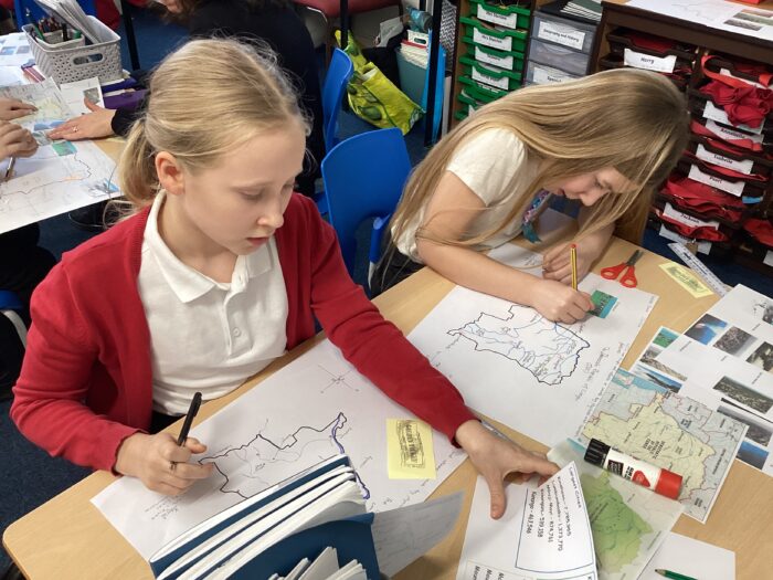
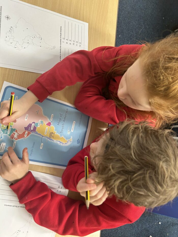
Pupils should extend their knowledge and understanding beyond the local area and the United Kingdom to include Europe, North and South America. This will include the location and characteristics of a range of the world’s most significant human and physical features. They should develop their use of geographical tools and skills to enhance their locational and place knowledge.
Pupils should be taught to:
- locate the world’s countries, using maps to focus on Europe and North and South America and concentrating on their environmental regions, key physical and human characteristics, countries, and major cities
- name and locate counties and cities of the United Kingdom, geographical regions and their identifying human and physical characteristics, including hills, mountains, cities, rivers, key topographical features and land-use patterns; and understand how some of these aspects have changed over time
- identify the position and significance of latitude, longitude, Equator, Northern Hemisphere, Southern Hemisphere, the Tropics of Cancer and Capricorn, Arctic and Antarctic Circle, and time zones (including day and night)
- understand geographical similarities and differences through the study of human and physical geography of a region or area of the United Kingdom (different from that taught at Key Stage 1), a region or area in a European country, and a region or area within North or South America
describe and understand key aspects of:
- physical geography, including: climate zones, biomes and vegetation belts,
- rivers, mountains, volcanoes and earthquakes, and the water cycle
- human geography, including: settlements, land use, economic activity including trade links, and the distribution of natural resources including energy, food, minerals, and water supplies
- use maps, atlases, globes and digital/computer mapping to locate countries and describe features studied
- use the eight points of a compass, four-figure grid references, symbols and key (including the use of Ordnance Survey maps) to build their knowledge of the United Kingdom and the wider world
- use fieldwork to observe, measure and record the human and physical features in the local area using a range of methods, including sketch maps, plans and graphs, and digital technologies.
The National Curriculum for geography aims to ensure that all pupils:
- develop knowledge of the location of places of global significance, their defining physical and human characteristics and how they relate to one another; this place knowledge should provide a sound context for understanding geographical processes
- understand the processes that give rise to key physical and human geographical features of the world, how these are interdependent and how they bring about spatial variation and change over time
are competent in the geographical skills needed to:
- collect, analyse and communicate with a range of data gathered through experiences of fieldwork that deepen their understanding of geographical processes
- interpret a range of sources of geographical information, including maps, globes, aerial photographs and Geographical Information Systems (GIS)
- communicate geographical information in a variety of ways, including through maps and writing at length.
Useful Links and Resources
Here are our policies related to geography teaching and some useful websites to help children learn more about geography.